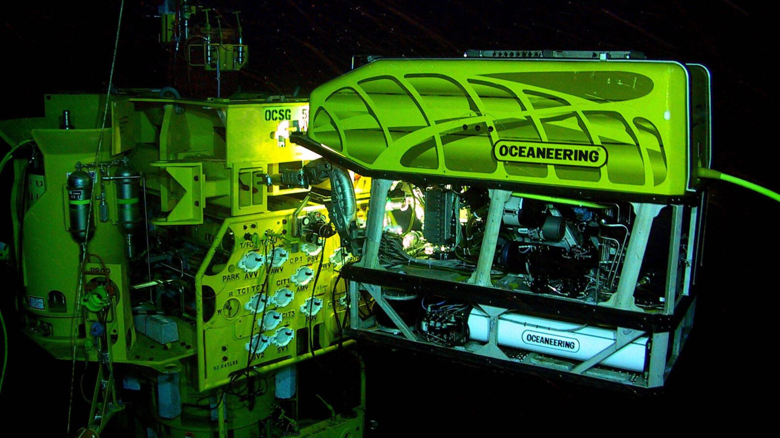
Remotely operated vehicles, oceanographic sensors and automated image analysis are changing the ways underwater environments are inspected and studied. But a technology demonstration is not the same as a technically reliable operation.
Other languages: Español · English · Português
A camera descends through the water column. On the surface, an operator adjusts the movements of a tethered vehicle. The display shows submerged structures, sediment and areas difficult to inspect. The equipment can capture video without immediately sending a person to the location, but operating it still requires planning, maintenance and technical judgment.
What an ROV is and what it cannot do
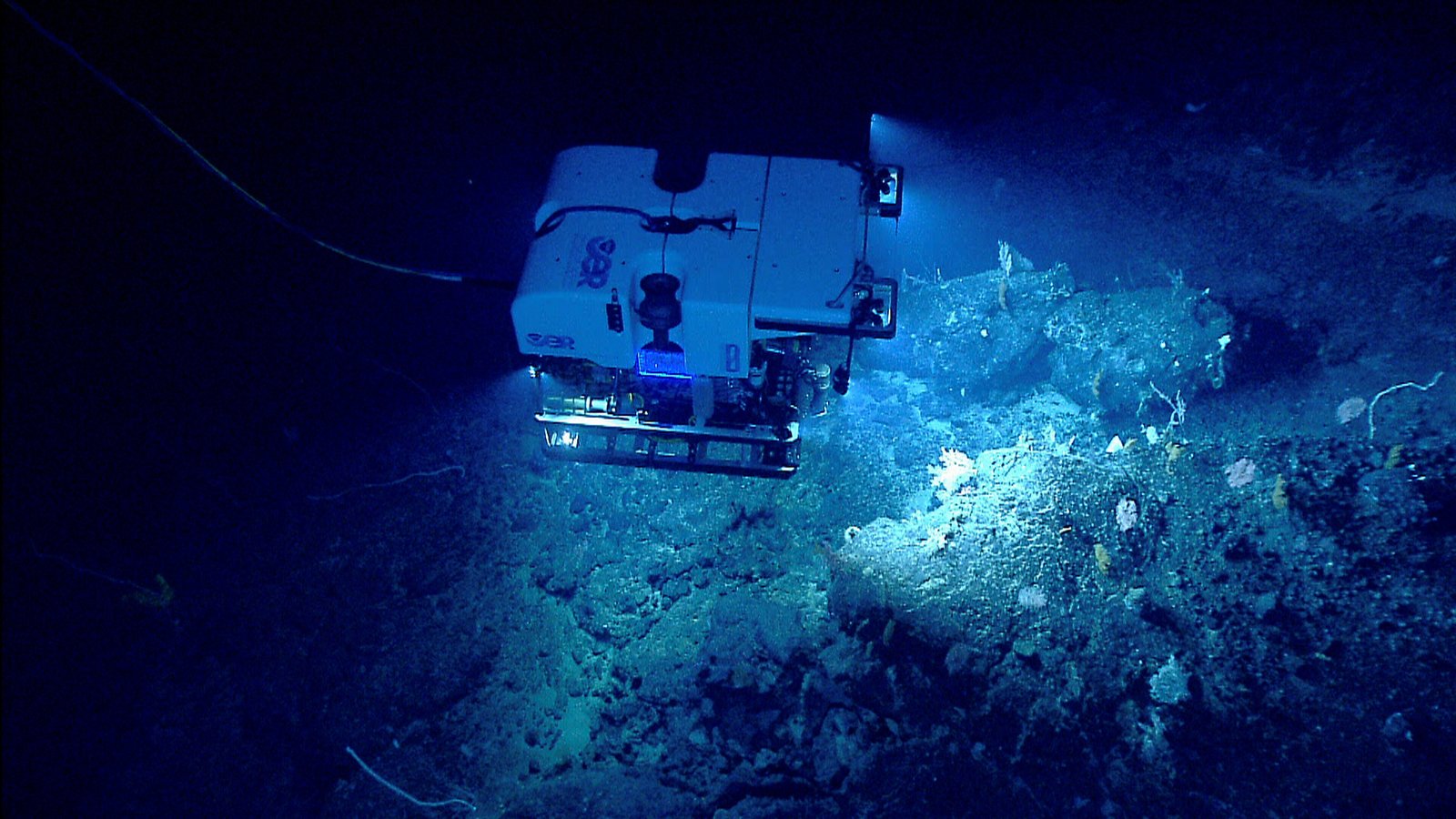
An ROV is an uncrewed underwater vehicle controlled from the surface. It is usually connected to a control station by a tether carrying power, commands or data. It should not be confused with an autonomous underwater vehicle, or AUV, which is designed to carry out certain missions with less direct real-time control.
NOAA describes ROVs as tools able to transmit live imagery and, when appropriately equipped, operate sensors or manipulators. Compact visual-inspection models and much more complex industrial or scientific systems serve different purposes.
Advertised depth ratings and camera resolution are insufficient for comparing capabilities. Currents, visibility, maneuverability, tether strength, reliability, recovery and operator competence also matter. A small vehicle may be excellent for observation but unsuitable for moving loads.

Industrial inspection: observe before intervening
ROVs can support visual inspections of hulls, piers, water intakes, tanks, cisterns and other structures that the vehicle can reach. They can identify sediment, visible obstructions, loose components and areas needing further technical assessment.
A visual inspection is not a complete structural certification. A crack seen on camera does not reveal its depth, mechanical significance or cause. Measurements, supplementary tests and qualified personnel may be required before conclusions can be drawn.
Turbidity, confined spaces, obstacles and the risk of tether entanglement are real limitations. ROVs may reduce direct human exposure for some tasks, but they do not eliminate deployment, recovery or maintenance risks. Nor do they automatically turn a confined space into a safe environment.
Sensors: measuring what cameras cannot see
A camera can show sediment or coral, but it cannot by itself measure water composition. CTD instruments record conductivity, temperature and depth, variables used to characterize the water column. Other sensors measure dissolved oxygen, turbidity, pH, currents and various environmental parameters.
Sonar can support navigation or acoustic representations of surfaces in limited visibility. Photogrammetry produces models from overlapping images when a suitable method is used.
Not every ROV can carry these instruments. Moreover, a measurement is useful for a particular purpose only if the sensor has suitable accuracy, is calibrated and records location, time and method. A number on a screen is not automatically valid evidence for a regulatory audit or scientific study.
| Tool | Primary data | Application |
|---|---|---|
| ROV camera | Images and video | Visual inspection |
| Sonar | Acoustic returns | Navigation and geometry |
| CTD | Conductivity, temperature, depth | Water column |
| Dissolved oxygen | Oxygen concentration | Environmental monitoring |
| Photogrammetry | Models from images | Spatial comparison |
| AI | Patterns in datasets | Classification support |
Artificial intelligence: processing images without replacing experts
Underwater observation produces hours of video and thousands of photographs. Manually reviewing material to locate organisms or describe habitats takes time. MBARI and its partners develop FathomNet, a database of annotated underwater imagery used to train and evaluate machine-learning tools.
In April 2026, the program announced a challenge aimed at improving automated annotation of marine-life images. The purpose is to support analysis of large collections, not demonstrate that machines can interpret any ecosystem without oversight.
Models may fail when species, lighting, turbidity or seabed characteristics differ from training data. A lack of representative examples can amplify errors. Scientific and technical classification requires specialist validation and methods that reveal limitations.

Reef monitoring: no single tool tells the whole story
Combining repeated imagery, sensors and data analysis can document environmental change. NOAA uses measurements including temperature and salinity, alongside ecological assessment methods, to study Pacific reefs.
Without a consistent protocol, photographs taken on different days can create misleading impressions of coral health due to angle or lighting changes. A sensor cannot independently identify the cause of disease, and a camera does not capture every species present.
The value comes from matching instruments to specific questions, documenting collection conditions and integrating measurements with scientific observation. Automated processing supports, rather than replaces, ecological interpretation.
Will ROVs replace human divers?
The answer depends on the task. An ROV can be useful for observation, but repairs, complex manipulation and some operations still require capabilities that many remote vehicles lack. Sometimes the best solution combines an initial ROV inspection with a later intervention by commercial divers.
Buying a robot is not its full operating cost: operators, training, maintenance, transport, batteries, parts, data analysis and sometimes a vessel are required. Savings must be demonstrated through comprehensive comparison.
Technology creates value when it reduces unnecessary exposure, improves evidence or makes a previously impractical task possible. None of these advantages should be assumed without analyzing the actual operation.
The most valuable product is trustworthy information
Attractive footage is insufficient for a professional inspection. Records need to identify the asset, date, areas observed, visibility conditions and inspection limitations. Where necessary, they should include measurements, locations of findings, plans and technical interpretation criteria.
That changes the underwater-services proposition: customers are not simply buying hours beneath the surface; they are buying evidence that supports decisions. An unverified image can confuse, while traceable records can help plan maintenance, assess risk or commission specialist tests.
Latin America has opportunities in port infrastructure, water systems, industrial installations and marine conservation. The potential is genuine, but it depends on combining underwater expertise, appropriate instruments and rigorous analysis. The future will be defined not by futuristic-looking hardware but by reliability in real operating conditions.
The next stage of underwater operations
ROVs, sensors and artificial intelligence do not form one universal solution. Integrating them requires trained operators, maintenance procedures, calibration, data management and risk assessment. Equipment suitable for research will not necessarily be appropriate for industrial inspection or regulatory evidence.
Latin America’s opportunity lies in matching technology with verifiable problems and developing the expertise to interpret its outputs. If implementation does not improve safety, cost or decision quality, innovation remains a presentation feature. Its actual value is demonstrated under real operating conditions.